Showing posts with label Panchbibi. Show all posts

Wednesday, March 16, 2016

Panchbibi Upazila in Joypurhat District,Bangladesh

Panchbibi Upazila 

Panchbibi
পাঁচবিবি
Upazila
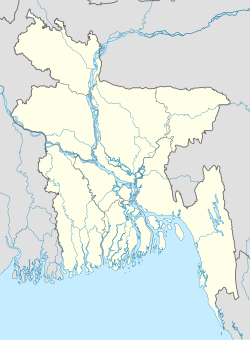
Panchbibi is located in Bangladesh
Panchbibi
Panchbibi
Location in Bangladesh
Coordinates: 25°11.7′N 89°1.2′ECoordinates: 25°11.7′N 89°1.2′E
Country  Bangladesh
Division Rajshahi Division
District Joypurhat District
Area
 • Total 278.53 km2 (107.54 sq mi)
Population (1991)
 • Total 193,365
 • Density 694/km2 (1,800/sq mi)
Time zone BST (UTC+6)
Website Official Map of Panchbibi
Panchbibi (Bengali: পাঁচবিবি) is an Upazila of Joypurhat District in the Division of Rajshahi, Bangladesh. It is bounded by Hakimpur and Ghoraghat upazilas and West Bengal of India on the north, Joypurhat Sadar upazila on the south, Gobindaganj and Kalai upazilas on the east, Joypurhat Sadar upazila and West Bengal of India on the west.
nces

Geography

Panchbibi is located at 25.1958°N 89.0208°E . It has 38,555 household units and a total area of 278.53 km².

Demographics

As of the 1991 Bangladesh census, Panchbibi has a population of 193,365. Males constitute 51.06% of the population, and females 48.94%. This Upazila's population of people aged eighteen and higher is 99,108. Panchbibi has an average literacy rate of 30.6% (7+ years), against the national average of 32.4% literate.

Administrative

Panchbibi has 8 Unions/Wards, 222 Mauzas/Mahallas, and 257 villages.

See also

  • Upazilas of Bangladesh
  • Districts of Bangladesh
  • Divisions of Bangladesh

References


  • Shahnaz Parveen (2012), "Panchbibi Upazila", in Sirajul Islam and Ahmed A. Jamal, Banglapedia: National Encyclopedia of Bangladesh (Second ed.), Asiatic Society of Bangladesh


    1. "Population Census Wing, BBS.". Archived from the original on 2005-03-27. Retrieved November 10, 2006.

    Tuesday, March 15, 2016

    পাঁচবিবি উপজেলা:-

    পাঁচবিবি উপজেলা বাংলাদেশের জয়পুরহাট জেলার একটি প্রশাসনিক এলাকা।

     অবস্থান ও আয়তন:-এই উপজেলার আয়তন ২৭৮.৫৩ বর্গ কিমি। উত্তরে দিনাজপুর জেলার হাকিমপুর উপজেলা ও ঘোড়াঘাট উপজেলা এবং ভারতের পশ্চিমবঙ্গ, দক্ষিণে জয়পুরহাট সদর উপজেলা , পূর্বে গাইবান্ধা জেলার গোবিন্দগঞ্জ উপজেলা ও কালাই উপজেলা, পশ্চিমে জয়পুরহাট সদর উপজেলা ও ভারতের পশ্চিমবঙ্গ। প্রধান নদী : ছোট যমুনা, তুলসীগঙ্গা ও হরবতী ।


    ইতিহাস:-

    পাঁচবিবি উপজেলা একটি প্রাচীন স্থান। এখানে খ্রিষ্ট পূর্ব সময়কাল থেকে বিভিন্ন সময় জনপদ তৈরী হয়েছে। নামকরণের বিভিন্ন মত রয়েছে। পূর্বে এই উপজেলার নাম ছিল লালবাজার থানা। পারস্যের বণিকেরা লালবাজার এলাকার সমৃদ্ধি দেখে পানসিভার শব্দ থেকেও পাঁচবিবি নাম করণ হতে পারে বলেও কিংবদন্তী রয়েছে। কেউ বলেছেন প্রাচীন জনপদ পঞ্চগৌড় এর রাজধানী ছিল পাঁচবিবি। পঞ্চগৌড় বিকৃত হয়ে পঞ্চগৌরীতে এবং পঞ্চগৌরী রূপান্তরিত হয়ে পঞ্চ হতে পাঁচ এবং গৌরী হতে বিবি অর্থাৎ পাঁচবিবি হয়েছে। একজন ঐতিহাসিক বলেছেন পাঞ্চাবিবি নামের একজন বৃদ্ধার জমিতে পাঁচবিবি রেলষ্ট্রেশন স্থাপিত হয়। ফলে রেলষ্ট্রেশনের নাম রাখা হয় পাঁচবিবি এবং সেখান থেকে পাঁচবিবি হয়েছে। নাম করণের ক্ষেত্রে বিতর্ক থাকলেও ইতিহাস পর্যালোচনা করলে দেখা যায় আনুমানিক বাংলা ১১০০ সালে (১৭০০খ্রীঃ) বাগুড়ী (বর্তমান খাসবাগুড়ী) এলাকায় এক মুসলিম দরবেশ এর পর্যায়ক্রমে পাঁচ জন বিবি ছিলেন। তাঁরা প্রত্যেকে ধর্মপরায়ন, কামেল, ও শ্রদ্ধেয়া ছিলেন। পাঁচজন স্ত্রী মৃত্যুবরণ করলে খাসবাগুড়ী ছোট যমুনা এর তীরবর্তী স্থানে তাঁদের পাঁচটি মাজার স্থাপিত হয়। তাঁদের স্মৃতি ও সম্মানার্থে তখনএলাকাবাসী সে স্থানকে ‘পাঁচবিবি দরগাহ’ পরর্বতীতে ‘পাঁচবিবি’ নামে ডাকত। খাসবাগুড়ী স্থানটি এখনও পুরানো পাঁচবিবি নামে সমাধিক পরিচিত। নদীভাঙ্গনের কারণে ১৮৬৮ সালে ১৬ই মার্চ লালবাজার থানা সদর বেল-আমলার লালবাজার স্থান হতে পাঁচবিবি দরগায় তথা পাঁচবিবিতে স্থানান্তর করা হয়। তথন থেকে এর নাম হয় পাঁচবিবি।

    1. ভৌগোলিক উপাত্ত

      ভাষা ও সংষ্কৃতি

      প্রশাসনিক এলাকা

      উপজেলা শহর ৯টি ওয়ার্ড ও ১৩টি মহলা নিয়ে গঠিত । আয়তন ৫.৮৩ বর্গ কিমি। জনসংখ্যা ২০১০২; পুরুষ ৫২.৩০%,মহিলা ৪৭.৭০%। জনসংখ্যার ঘনত্ব প্রতি বর্গ কিমি ৩৪৪৮জন। শিক্ষার হার ৫২.২%। প্রশাসন পাঁচবিবি থানা সৃষ্টি ১৮৬৮সালে । বর্তমানে এটি উপজেলা । ইউনিয়ন ৮, গ্রাম ২৫৭, মৌজা ২২২, পৌরসভা ১।

      জনসংখ্যার উপাত্ত

      জনসংখ্যা ২,৪০,৭৯৭ জন; পুরষ ১,২৩,৯০৯ জন ও মহিলা ১,১৬,৮৮৮ জন।

      স্বাস্থ্য

      শিক্ষা

      শিক্ষার গড় হার ৩০.৬%; পুরুষ ৩৮.১%, মহিলা ২২.৭%।
      • কলেজ - ৫টি (বেসরকারিঃ ৪, সরকারিঃ ১),
      • মাধ্যমিক বিদ্যালয় - ২৪টি (বেসরকারিঃ ২২, সরকারিঃ ২),
      • নিন্ম-মাধ্যমিক বিদ্যালয় - ১০টি,
      • মাদ্রাসা - ২৮টি,
      • প্রাথমিক বিদালয় - ৮৬টি (সরকারিঃ ৫৮, বেসরকারিঃ ২৮),
      • কারিগরি শিক্ষা প্রতিষ্ঠান - ১টি।

      কৃষি

      • উত্পন্ন দ্রব্য - ধান, ইক্ষু, পাট, কচু, গম, কচুর লতি, আলু, পটল, সবুজ শাকসবজি।

      অর্থনীতি

      অধিকাংশ মানুষ কৃষির উপর নির্ভরশীল। বর্তমানে কচু এবং কচুর লতি বিদেশে রপ্তানী হয়|

      যোগাযোগ ব্যবস্থা

      কৃতী ব্যক্তিত্ব

      • আব্দুল হামিদ খান ভাসানী।

      দর্শনীয় স্থান ও স্থাপনা

      বিবিধ

      আরও দেখুন

      • বাংলাদেশের উপজেলাসমূহ;
      • জয়পুরহাট জেলা;
      • রাজশাহী বিভাগ।

      তথ্যসুত্র


    2. "এক নজরে পাঁচবিবি"। বাংলাদেশ জাতীয় তথ্য বাতায়ন। গণপ্রজাতন্ত্রী বাংলাদেশ সরকার। জুন, ২০১৪। সংগৃহীত : ১০ জুলাই ২০১৪।

    3. বাংলাদেশ জাতীয় তথ্য বাতায়ন (জুন, ২০১৪)। "পাঁচবিবি উপজেলার পটভূমি"। গণপ্রজাতন্ত্রী বাংলাদেশ সরকার। সংগৃহীত ১১ জুলাই, ২০১৪।


    Saturday, March 12, 2016

    Joypurhat District Information

    Joypurhat is small district located in the northern part of Bangladesh. The previous name of the region was “Baghabari Hat” and next it was written “Gopandraganj Hat” in historical documents. During the British East India period, Joypurhat Railway station and post office was established and named Joypurhat to make differ with the name of Joypur located in current India. Then the region got familiarity with the name of Joypurhat with the passing of age. A police station named Joypurhat was established in 1907. Joypurhat was the only subdivision of the formerly Bogra district. After the liberation of Bangladesh, Joypurhat started its journey as a district in 1984. Saotal, Orao, Munda, Mohali, Mohanta, Rajhangshi etc tribes also found in the district and total population of such tribes is about forty seven thousand.


    Bordered By:
    Joypurhat District is bordered by Dinajpur, Gaibandha district and West Bengal (Indian State) to the north, Bogra and Naogaon district to the south, Bogra and Gaibandha districts to the east, Naogaon districts and West Bengal to the west.

    Administration: The area of Joypurhat is 1012.41 Sq Km. It is under Rajshahi Division. There are 04 Municipalities in Joypurhat named Akkelpur, Kalai, Joypurhat and Pachbibi. The number of Upazilla (sub district) in Joypurhat district is 05, named- Joypurhat, Khetlal, Akkelpur, Kalai and Pachbiby containing 32 Unions, 661 Mauzas and 887 Villages.

    Population: The total population of Joypurhat district is 913,768 (Male- 459,284 and Female- 454,484), sex ratio 101:100, Population Density 903/Sq Km and annual growth rate is 0.75%.

    Literacy: The Literacy Rate of Joypurhat district is 57.50% (Male- 61.40% and Female- 53.50%). School attendance rate is 56.60% for 5 to 24 years age group. There ere no university, 42 collage (including 3 govt collage), a women cadet collage, 165 secondary high school (including gov. 4), 350 primary school (including gov- 263), a technical school and collage, 13 technical educational institutions, 111 Madrashas, 01 PTI in Joypurhat.

    Other Improtant Data: The postal code of Joypurhat district is 5900 and NWD Code is 0571. Total Parliament seat in Joypurhat is 02. During the liberation war, Joypurhat was under Sector Number 07. Urbanization rate of the district is 15.75%. The remarkable Mineral resources of the district are Coal, Limestone etc and average annual average rainfall is 1610 mm.

    Rivers: Choto Jamuna, Tulshi Ganga, Haramoti, Chiri, Sree Nadi etc.

    Agro Products: Paddy, Sugarcane, Jute, Turmeric, Banana, Potato, Mango, Jack fruit, Pulses, Yam, Betel Leaf, Tobacco, Oil seeds etc.

    Remarkable Personalities from Joypurhat District
    Bina Pani Sarker, Comored Abdul Kader Chowdhury, Mihir Mukharjee, Ataur Rahaman (Poet), Fatema Tuz Zohara (Singer), Dr Farid Uddin, Dr Abdul Kader Chowdhury, Shahid Mujibur Rahaman, Principal Mohshin Ali Dewan, Abbas Ali Khan, Abdul Alim etc.

    joypurhat, bangladesh

    Famous Tourist Places in Joypurhat District
    Khasmohol Bhaban, Ber Amla Bershibaloy, Pitarer Banglo, Joypurhat Sugar mills, Cement Factory, Pachbibir Mazar, Nandail Lake, Ashranga Lake, Bastob Puri, Graveyard of Mukshid Gazi, Pagla Dewan Mass Graveyard, Gopinathpur Temple, Shisu Uddyan, Nandail Lake, Ashranga Lake, Joypal Rajar Rajbari, Baro Shibmondir, Shrine of Pathorghata, Abul Quashem Field in Sadar, Central Shahid Minar, Joypurhat Cadette College, English Market etc.